02.2025 Story
Talking about Kuanyin Mountain Jiuzhongling Trail
Ya Tung Ready Mixed Concrete Corporation / Lind


You may know that Kuanyin Mountain's "Hardman Ridge" is a great place to enjoy the sunset, sunset, night view, and sunrise scenery in the suburbs of Greater Taipei, but you may not know that there are actually several different paths leading to "Hardman Ridge". This article shares with you some of the favorite secret paths for mountain enthusiasts, and welcome to explore together.

At an altitude of 616 meters, most people choose to take the MRT to Luzhou Station and then transfer to the G20 bus to the tourist center at the main station. They can then climb the mountain step by step on the Fenggui Douhu Trail next to the tourist center, which takes about an hour to reach; Alternatively, take bus 875 from Luzhou Station on the MRT to Lingyun Temple at Guanyin Mountain Station, and climb the mountain from the entrance on the left side of Lingyun Temple. This is an early old trail, not far from the stairs, with a red stone monument marked "Hardman Road". Along the way, you will pass by the stone monument of the "Weak Club", and the whole journey takes about 1 hour and 10 minutes.
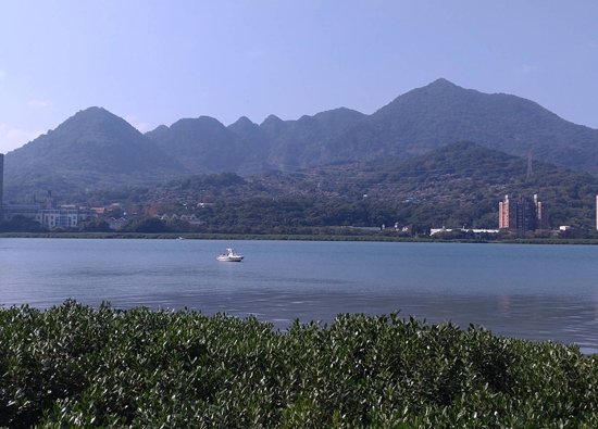
After passing through the archways on both sides that read 'When walking, find difficult paths; when carrying burdens, choose heavy ones', you will arrive at the mountaintop platform, where the view is excellent. To the left, you can see Taipei Port The Tamsui River estuary, as well as the under construction Tamkang Bridge, Fisherman's Wharf, and other beautiful scenery. To the right is the Guandu Bridge, the Taipei Basin, and one can also overlook the mountains of Datun. From March to May every year, it is the season for migratory birds to migrate northward. Due to its geographical location, Guanyin Mountain has become a stopover for raptors, and spectacular scenes of eagles spreading their wings and surrounded by flocks of eagles can often be seen.
However, many climbers do not take the aforementioned public roads, but instead challenge the steep entrance staircase on the right side of Lingyun Temple, which leads to a peak at an altitude of 380 meters. The platform here is very large and the view is also very good. You can see the Tamsui Line MRT running from Guandu Bridge to Tamsui River estuary on the right bank.
If you get off at the "Guanyin Mountain" bus stop on Lingyun Road Section 3 (G20, 875), the stairs to the left will lead to Lingyun Temple, and the small lane to the right will lead to Chaoyin Cave. You can also steep up the mountain by taking the stairs.
In addition, after getting off at the "Guanyin Li" bus stop, the small road heading north can steep up Fulong Mountain (also known as Yingzaijian) at an altitude of 434 meters. This section of the road requires climbing ropes all the way up, so gloves must be prepared to grip the ropes. Even without rest, it takes 20 minutes to climb, which is very physically demanding.
Although there is a road connecting Jianshan and Yingzaijian mentioned above, the steepness can reach up to 50-60 degrees, requiring the use of mountain trails, climbing ropes, and stairs in a staggered manner. The section from Jianshan to the North Cross Island Highway will pass through four small peaks with high steepness, and then reach the North Cross Island Trail opened by early mountaineering teams. Under the shade of trees throughout the journey, the trail starts from one section and passes through two sections, forming a gentle slope; 2、 At the junction of the three sections, you can climb the rope for 40 minutes straight up to the "Hardman Ridge" (about 50 or 60 degrees), which is considered the hardest road in Greater Taipei. It tests your thigh muscles, and every step you take, it almost exceeds 25 to 35 centimeters. Mountain enthusiasts jokingly call this road "101 in the mountains". If you don't choose to climb the "Hardman Ridge" on the rope, you can also continue walking the fourth, fifth, and sixth sections of the North Cross Island Highway to reach the Guanyin Mountain Tourist Center. Among them, the fifth section is a steep rope climbing road, and the sixth section of Huangtu Mountain Road is wide but steep, which tests your calf muscles.
In fact, there is also a section of road leading to the Big Stone Wall at the entrance of the North Cross Island Highway. One of the sections is a steep cliff with a rope pull angle of about 70-75 degrees and a length of 30 meters. Climbing the rope straight can be described as a thrilling step by step, and every step must be stepped on steadily. The Lingyun Peak and Erjian Peak at an altitude of 503 meters and 537 meters respectively are steep mountain paths that lead to the "Hardman Ridge".
From the direction of descending the "Hardman Ridge", you can see the stone tablet archway with the words "Come to be a tough man, go to be a tough man". Follow the stairs down to the tourist center, or take the Niuliao Pu Staircase Trail from the public restroom pavilion to the right down. It takes about 100 minutes to reach the Bali Ferry Terminal all the way, as it is a staircase that actually tests the calf muscles.
Looking at the mountain path up and down Guanyin Mountain's "Hardman Ridge", there are 5 entrances on Lingyun Road and 3 exits in Bali, with 9 peaks towering in the middle and multiple mountain paths connected in a network, making it the "Guanyin Mountain Jiuchong Ridge Trail".


